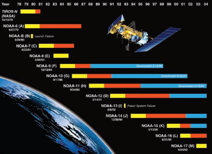
NOAA’s top satellite frequencies include 137.100 MHz, 137.620 MHz, 137.9125 MHz, 1698 MHz, 1707 MHz, and 1702.5 MHz for real-time weather imaging.
137.100 MHz
137.100 MHz is one of the main frequencies NOAA satellites use to send APT signals. This frequency is especially important for weather enthusiasts, meteorologists, and researchers who heavily rely on updated weather data for tracking the development of storms, forecasting the shifts of the weather, and researching the environment. By tuning into 137.100 MHz, one is applying to receive real-time images directly transmitted from NOAA satellites. These images are of huge importance for the general public and numerous country services, for they allow tracking the weather — and particularly unfortunate events of hurricanes and tornadoes with their help. For example, during hurricanes, images from the satellites may help predict the trajectory of the hurricane, and by estimating through which of these territories it is about to go, the residents can be warned long before it is there, which may potentially save countless humans and property.
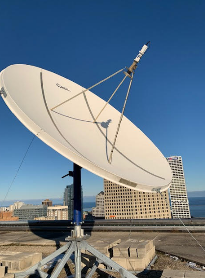
As of receiving equipment, it may range from $150 to $300 for purchasing a VHF, which is a simple VHF antenna, the receiving device, which is usually a simple radio scanner with the 137.100 frequency, and a pc software for decoding the signal. The resulting investment, given that now up to date weather information is available to one at any moment, is quite impressive for the applicability of the decoded data in many spheres from agriculture to disaster relief management.
By receiving this data, the users can set up automated systems that receive the data of the satellite passing, record, decode it, and even upload the video to the internet so the findings can be correlated with those of other enthusiasts. This further allows connecting to the community of weather lovers who will both nourish you with the received data and can be represented with your data to better prepare and protect each other.

137.620 MHz
One other frequency, 137.620 MHz, must also be mentioned because it is no less important for NOAA satellites. This is an APT signal transmitting frequency that most weather watchers, including amateur radio enthusiasts, meteorological stations, and educational institutions, would need because it provides the most detailed images. This frequency is used to track fast-moving weather variations, particularly those that may require warning public. If there is a thunderstorm passing your town and you would kindly like to know how much longer it must rain, you may use images received from NOAA satellites at 137.620 MHz. They could shed light on whether the storm is quick or slow, dissipating or intensifying.
Reception station for the 137.620 MHz would require a moderate investment in a relatively low-quality VHF antenna, radio-receiver for about 137 MHz, and a decoding program. It is possible to buy all the items for $200-500, depending on the quality of each component and the availability of the decoding equipment. The benefit of having the 137.620 MHz received would be knowing in advance about the upcoming storms, which may cause damage to property or pose a danger to human lives. Therefore, setting up the station would pay off very quickly, and, in addition, students have yet another opportunity to conduct weather-related research on their own.
137.9125 MHz
137.9125 MHz are vital for both hobbyists and professionals who need to observe the weather in real time using NOAA satellite’s service. When correctly set up, this frequency provides the users with the ability to access the satellite-imaged data and interpret it to keep abreast of the weather changes.
In an agricultural application, the data from 137.9125 MHz is used by farmers to take timely decisions on seeding, watering, fertilizing, and other aspects of farming. By keeping an eye on the incoming weather systems and the temperature changes, one could ensure that pesticides or fertilizers are only applied to soil or plants when they will be most effective. The cost-savings of such measurements could reach up to several hundred thousand dollars depending on the area affected by the soil and the specific requirements of each crop.
In the case of emergency teams, the frequency at 137.9125 MHz is used for assessing the current weather conditions. The timely and accurate image of the weather on the satellite can help in managing the deployment of the emergency and rescue forces to avoid the excessive impact of natural or other disasters. For instance, in case of flooding, the rescue team can be reported to adjust their deployment to the information from the satellite. It can save lives and reduce the economic damages.
The cost of the system includes the initial setup: VHF antenna to be permanently installed, the receiver, and the software for decoding. The initial cost depends on how professional the system is. The price of each unit varies from $100 to $400. The professionalism of systems installation or the quality and lifetime of the equipment are also varying considerably, with a consequent effect on picture clarity and stability. Many schools or research institutions set up such systems and use it in its academic processes to monitor and study meteorology.

1698 MHz
The frequency of 1698 MHz is critical and vital for HRPT. Sharing high resolution of Earth’s weather systems by NOAA satellite, that signal perfectly fits meteorologists, climatologists and advanced weather monitoring stations
One who uses 1698 MHz has broad access to the world in multiples of the important data for environmental track and weather prediction. This frequency is used by the meteorological agencies for monitoring clouds dynamics, storm origins, and oceanographic parameter s using high resolution data. This data also helps to increase weather prediction accurateness. According to Ngon, Sham Nawani, and Stoverjack, higher resolution data gives better results.
Using 1698 MHz leads to heavy investment in data receiving technologies. The price upgrowth starts from the high-quality perpective antenna to the new methodologies of data retrieving, as well as decoding software. Using HRPT signal requires receiving equipment of expenditure averagely from $1000 to $5000 due to the nature of the equipment required. The data received has it’s cost. Thus such expensive software is required as an outcome of detailed located images.
Educational utilization of 1698 MHz consists of equal amount of advantages as for the emergency planning stations. Settling the real-time satellite data in the basis of scientific studying results in an opportunity to make a live investigation of the data, whether simple or difficult. However the main practical advantage is in the usage of to the wide range of satellite data is application development. This data is a perfect source of educational utilization, starting from the analysis of it to live case studies and prior years meteorological analysis.
As for emergency planning station, using data from 1698 MHz leads to and event detailed tracking by images. As the HRPT is characterized by the high amount of data received, the processing of it by the technicians and professionals helps to advance the data of the efficiency, as it gives the full range of received data coming from such satellite images including, but not limited to temperature and humidity, going up to the detailed imaging of clouds, with volume and density. On top of this, the data received is useful and good referent in practical activities. For instance, a hurricane or wildfire can be tracked through the event using HRPT images for locating the direction of the going event. The benefits of such detailed tracking of disaster consist of the allocation of the resources optimality of the location, as well as the detailed informative assistance for the citizens on the going event at the current moment.
1707 MHz
1707 MHz is an important NOAA satellite frequency for High Resolution Picture Transmission, similar to 1698 MHz but used by other satellites or with slightly different data payloads. It is vital to environmental monitoring and as such is valued by meteorologists, environmental agencies, and research facilities. With 1707 MHz professionals can capture detailed high-resolution pictures and follow severe weather, such as hurricanes, tornadoes, and blizzards, in real-time. This can often mean the difference between escape on time and being trapped by a natural catastrophe, or sending help promptly to disaster-struck areas, rather than days after it is too late.
Since 1707 MHz images can also track weather changes, including low pressure areas, atmospheric fronts, and accumulated precipitation, such help also greatly enhances the accuracy of weather forecasting, previously so uncertain and rough. Notably, with tools such as 1707 MHz imaging, there need be no millions of human and economic losses such unpredictable weather fiascos entail. An example will highlight the use of 1707 MHz digital satellite imaging. Take, for instance, a hurricane. With 1707 MHz the weather specialists will receive real-time sighting of the minute-by-minute movement, growth, or decay. This will allow for earlier voting of an all-clear, or for funding and routing the appropriate emergency rescue teams. Also, accurate data on a tornado can dispatch cellars on time to those who listened to the severe weather watch .
The cost of a 1707 MHz system would be great in that only a very few can afford to spend even three or six grand on sophisticated S-band reception equipment and the necessary signal decoding and analysis hardware as well as software. Meanwhile, the payoff is high being the efficient tracking and predicting not easily identified nor decoded earthbound electrical phenomena firestorms, being as seen before. Moreover, the tension is also dissipated by the knowledge that the power of the atmospheric phenomena can be overestimated by the Atmsophereic Phenomena imagery only a closely watched satellite away. However, it is mostly the interested and professional who undertake these efforts. The professionals are employed and produce value of greater than six thousand all will agree. Commonly, universities and other research and educational facilities will also undertake similar efforts. The staff is paid there for the students are a different case. Students studying the data are engaged in activities leading to critical thinking, or to new skies investigating, or to new skills attaining. With a 1707 MHz system in place, there were really no extras to pay, certainly none for critical observation and data interpretation. Suppose, the purchase is made. What really matters is that EPA can better predict the need for disastrous emergencies, say the Ozone emergency, and inform the receiving hospitals accordingly. Meanwhile, it is only the smart ones who will order the correct amount of epinephrine saving everyone’s precious lives, let us all agree on this fact.
1702.5 MHz
1702.5 MHz is another main frequency of High Resolution Picture Transmission with the NOAA satellites. This frequency is crucial for the highly-professional weather forecasting and various environmental monitoring needs and can be the best for most of the scientific and professional needs because of the very precise data it provides. Thus, as for the high level of specialisation which 1702.5 MHz implies, the majority of its users are professionals to a certain extent. The latter includes various environmentalists who receive the images of high quality allowing them to monitor different changes in natural habitats. For instance, deforestation tracking is one of the assignment carried out by environmentalist towards saving the earth. Analyzing these very precise and modern images and comparing them to the older ones allows seeing all the dynamics even in the strongest hidden firms. Consequently, comparing the satellite images, one may also determine the exact influence of the human activities and for instance, the effect of deforestation in Amazon may be determined in a more scientific and legislative way. As for the images of 1702.5 MHz, these are high quality and very detailed images and they demand special antenna, receiver, and image decoding equipment to be received.
The cost of the equipment to receive the HRPT signals at 1702.5 MHz is very high, and in total it likely to take me from $2500 to $7000 to buy it or otherwise specialists who can help install it. However, this is likely to be one of the best investments as for data collecting because the equipment which the frequency presupposes demand guarantees the highest quality of the received data. That is why such an equipment may be sent, for example, to a developing country to allow different organizations there, which need the most precise data on the environment and weather to plan confirmations respond to disasters. This may be particularly crucial for saving the population living in other wise the dangerous places as for floods tragedies, for instance. Simultaneously, there also are certain educational needs for 1702.5 MHz. These presuppose mostly the students who deal with environmental science or meteorology and need the data as for studying precisely in these spheres.